Union of the Comoros – The Perfume Islands – Part 2: Mount Karthala Trek
My main motivation for visiting Comoros was to climb Mount Karthala. Mount Karthala is an active volcano that is 2361m high and is the most prominent geographical feature of Grand Comore. The volcano last erupted in 2005 and had a potential risk to the inhabitants. Luckily no one was harmed. Prior to the 2005 eruption, Mount Karthala seems to have had a crater lake in the caldera. However, after the eruption, it has changed in to a large field of volcanic ash.
The problem with Comoros is that it is very little known in the travel world. There are only so many references you would be able to find online and trekking operators was not one of them. All the references that I found about trekking to Karthala seem to refer to this one person ‘Chauffer’; a French word that also means ‘guide’. I wasn’t sure at all whether this was a description of a group of people (as in guides) or a nickname of a single person. When I made my bookings with my hotel in Comoros, I decided to let them know that I am interested in the trek, and asked them to make a booking on my behalf.
The trek can be done as a one day tour or a two day tour where you would camp half way to the top. My choice was to take a one day tour. The tour itself will cost you around 80 EUR and the guide will provide you with water and meals. The starting point of the trek starts at a place that is around 350-370m above sea level, so the climb itself is around 2000m. The trail is about 13.5km long one-way and will take about 6 hours to climb (12 hours for a return trip). The trail itself is not that hard to find and although there is a motorable road near to the top,it seems like the only vehicles allowed are the ones used by the researchers.
When you climb the mountain, you wouldn’t feel that you are climbing a volcano except for the dried lava flows you can see from time to time. The lower parts of the volcano are covered in evergreen forest and further up (beyond 1800m from sea level), the vegetation changes to shrubland species. The isolation of the islands have given rise to a limited, yet an interesting collection of fauna and flora that are endemic to the Comoros. The group that I joined for trek were had a few botanists who were from the Reunion Islands and were happy to discuss about the various endemic and indigenous plants we found on the way.

Evergreen forests at the lower parts of Mount Karthala 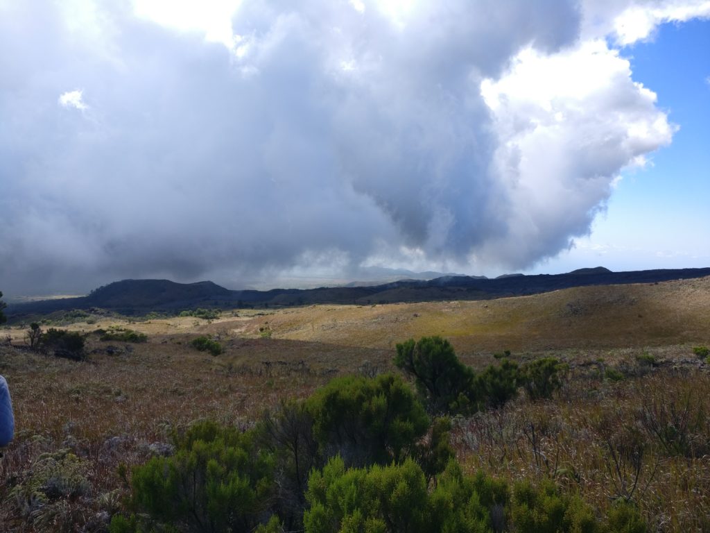
Shrublands of upper parts of Mount Karthala 
Dried lava flows
The first bird species I got to identify on the way appeared to be a Greater Vasa Parrot(Coracopsis vasa). Given the location, it is quite likely that this is the subspecies endemic to the Comoros. The second bird that I saw was definitely one in my planned list, the Karthala White-Eye (Zosterops mouroniensis). The Karthala White-Eye is a species endemic to the Grand Comore island and more specifically to the shrubland surrounding the Karthala mountain. The species is currently categorised under the Vulnerable list by IUCN. In my opinion, this particular species is a good example of natural,non-human driven extinction. The bird for some reason does not spread towards the lower evergreen forests. The eruption of Mount Karthala therefore, poses a direct threat to its habitat destruction and eventual extinction. Its cousin. the Oriental White-Eye (Zosterops palpebrosus) on the other hand spreads across many types of forests and therefore is able to preserve itself better.
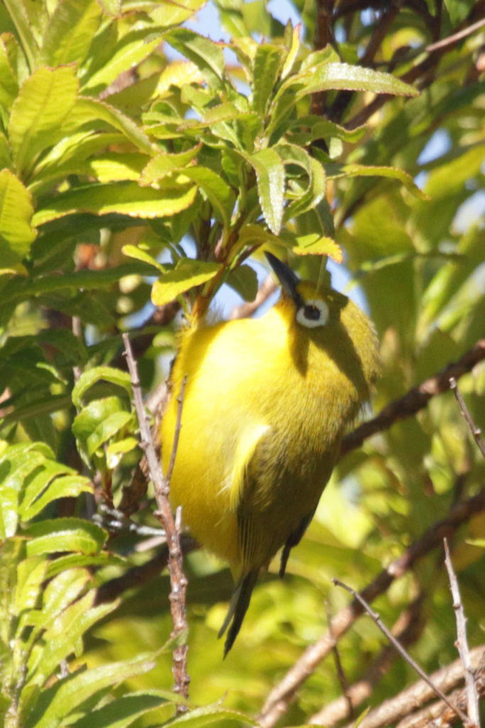
Karthala White-Eye (Zosterops mouroniensis) 
Greater Vasa Parrot (Coracopsis vasa) 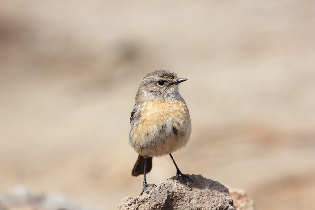
African Stonechat (Saxicola torquatus) 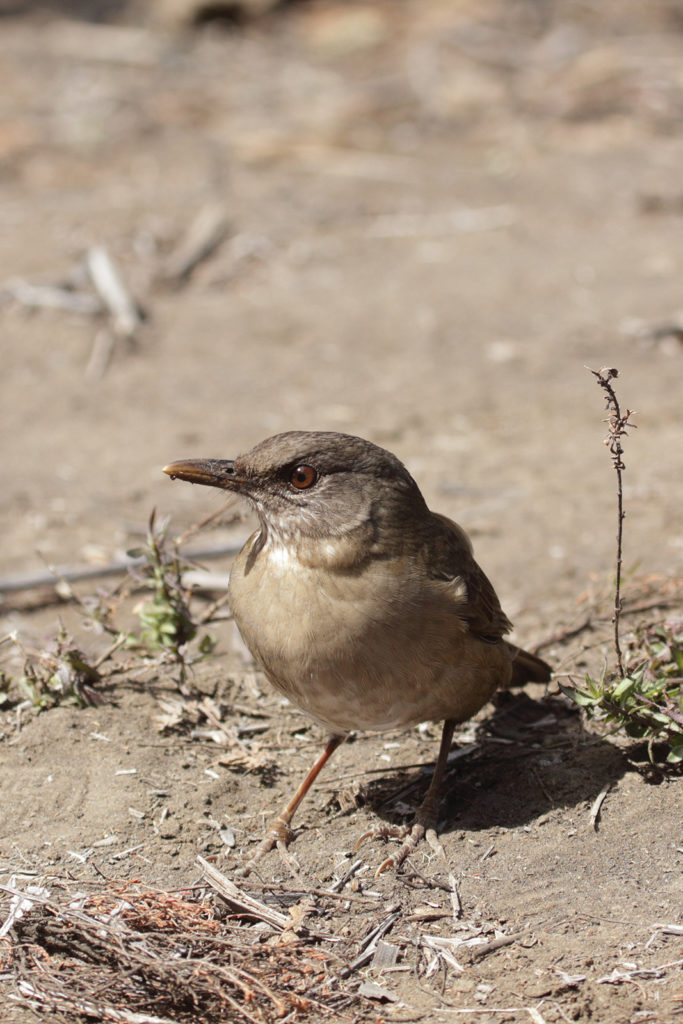
Comoros Thrush (Turdus bewsheri)
After an arduous 6 hour climb, I had to give my backpack over to the guide. As it appeared, the name ‘Chauffer’ actually refers to one guide who happened to be one of the oldest guides in Comoros. He is almost 70 years old and no longer does the trek. His son and a few others have now become the next generation of guides.
Once you get to the top of the peak, it is likely to take your breath away both literally and figuratively.The greenery that was present up to that is completely gone and what you see is the stereotypical desolated view of ash covered plains. The caldera of Mount Karthala is about 3km x 4km and is one of the largest calderas when it comes to shield volcanoes. Prior to its 2005 eruption, the caldera had a lake from rainwater accumulation. Unfortunately I was 13 years too late to visit it.
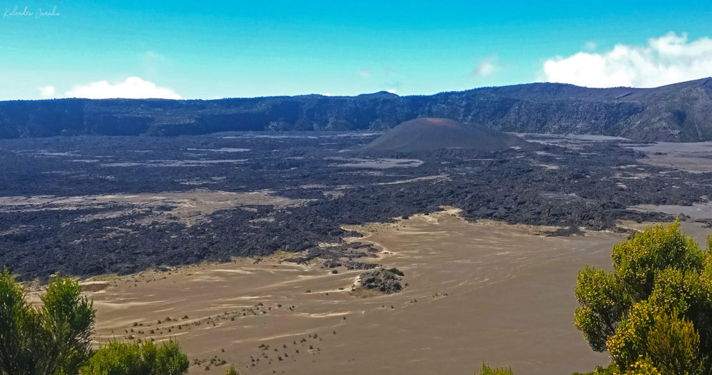
Panorama of the caldera on top of Mount Karthala
When you are climbing Karthala, do keep in mind that it is more than 2000m above sea level and can get extremely chilly. If you are staying overnight, proper warm clothes and a tent is a must. Even during the day, I found it very cold at the top due to the strong winds. The hiking path and the elevation profile related details can be found at my strava profile: https://www.strava.com/activities/1704626945. The GPX file for the descent is available at http://theaimlessalbatross.com/wp-content/uploads/2018-Comoros/KarthalaHike.gpx
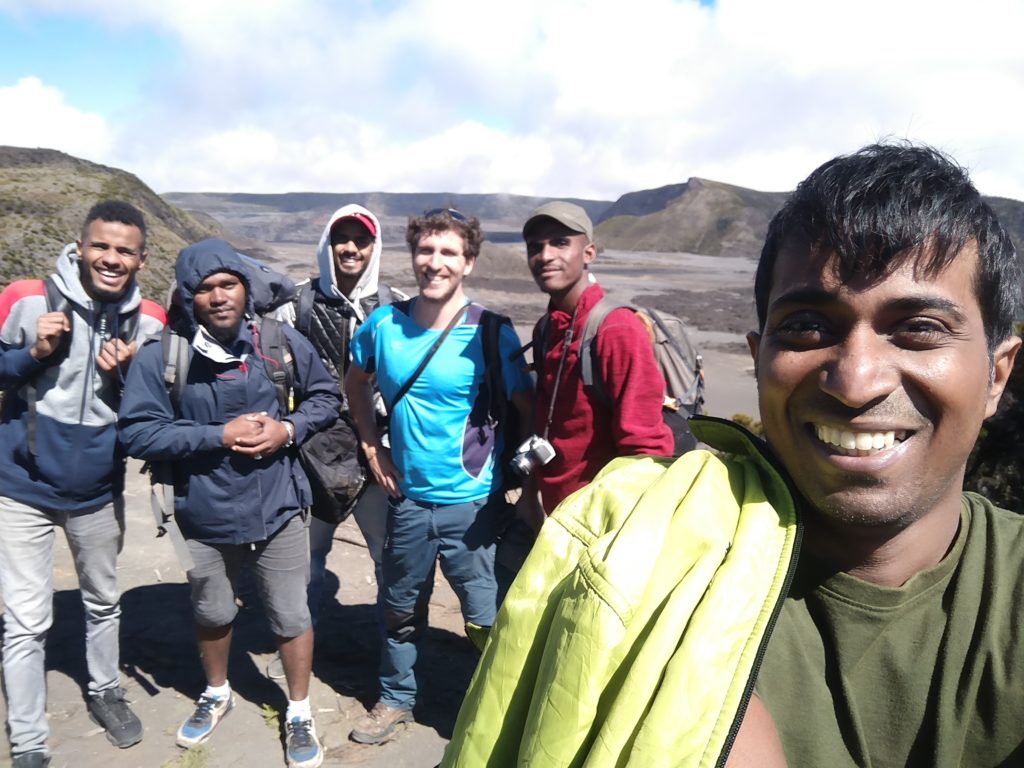
My trekking group. Second from left is our guide. 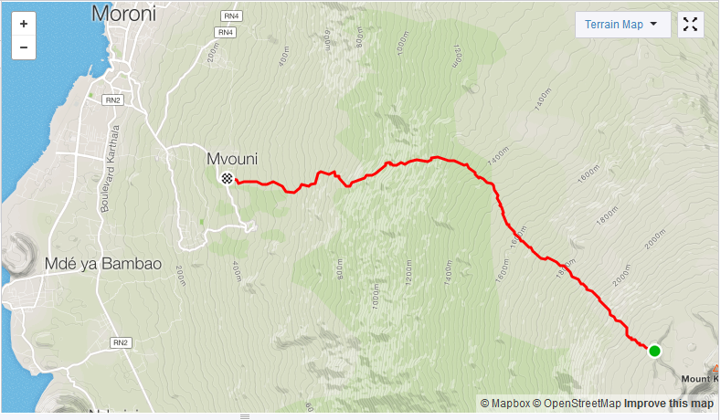
Mount Karthala trekking path (recorded on descent) 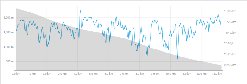
Elevation profile of Mount Karthala (recorded on descent)
When we started our descent, it was around mid-day, and it took around 5.5 hours to reach the bottom. By the end of that 12 hours, I had managed to cover at least two of the reasons why I wanted to come to Comoros and had done my longest trek ever.While I felt that the guide fees were way over the top, I wouldn’t have been able to make it to the top without my guide offering to take my backpack over from me. So all in all, it was a very good day for me, and also for the Comorians because France, a country that they identify with a lot, won the FIFA world cup that day.